


Schindleneggen
 |
CH (SZ), 8.7288°E, 47.0341°N | |||
 |
1562 m |  |
CH-SZ-1562 | |
 |
Tschalun, 1068m, 5km | |||
 |
Brunni, 1089m, 4km | |||
 |
||||
 |


")
| |||
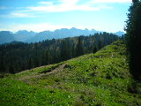
Schindleneggen, the crest towards Brünnelistock | ||||

The Grand Mythen as seen from Schindleneggen | ||||

The Small Mythen as seen from Schindleneggen | ||||