


Col de Valberg
 |
FR (06), 6.9178°E, 44.0893°N | |||
 |
1669 m |  |
FR-06-1669 | |
 |
Beuil, 1442m, 8km Ste-Anne, 1551m, 6km Valberg, 1673m, 2km | |||
 |
Guillaumes, 793m, 12km | |||
 |


")
| |||
 |
the main pass would by in the town of Valberg, but road sign and maps locate it further down on a very small shoulder... | |||
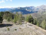
View from Col de Valberg to the north, with Montagne de l'Alp | ||||

Mont Mounier and Valberg as seen from Valberg pass | ||||