


Sirwoltesattel
 |
CH (VS), 7.9832°E, 46.2173°N | |||
 |
2621 m |  |
CH-VS-2621b | |
 |
Glis, 680m, 20km Mättwe, 1830m, 5km | |||
 |
Niederalp, 1820m, 4km | |||
 |
||||
 |


")
| |||
 |
quite steep track, beautiful passage on the west hillside of the Galehorn | |||
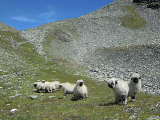
Valais sheep in the Nanztal below Sirwoltesattel | ||||

Sirwoltesattel, view from the pass to the west | ||||

Sirwoltesattel, view from pass to the east | ||||