


Gätterlipass
 |
CH (SZ), 8.5512°E, 47.0185°N | |||
 |
1190 m |  |
CH-SZ-1190a | |
 |
Gersau, 435m, 7km | |||
 |
Lauerz, 457m, 8km | |||
 |
||||
 |


")
| |||
 |
paved road on Gersau's side, road up to 2 km to the pass on Lauerz' side (also: signposted MTB track over Brunniberg to Schwyz) | |||
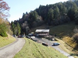
Gätterli Pass | ||||
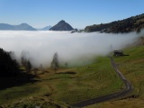
View from Gätterli towards Vitznauerstock, which comes out of the fog | ||||
Gätterli and Rigi Hochflue | ||||
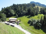
South Side of Gätterli with the Vitznauerstock | ||||
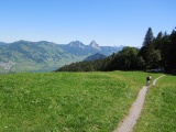
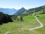
Track north of Gätterli, with the Mythen in the background | ||||