


Heumooser Pass
 |
CH (SG), 9.1683°E, 47.2009°N | |||
 |
1412 m |  |
CH-SG-1412 | |
 |
Nesslau, 757m, 9km Vorderlaad, 980m, 6km Stofel, 1141m, 2km | |||
 |
Nesslau, 757m, 5km Schneit, 815m, 3km Ijental, 1050m, 1km | |||
 |
||||
 |


")
| |||
 |
steep and unmarked path on the Ijental slope | |||
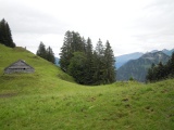
Heumooserhöchi, view to the south-east, with the Churfirsten in the background | ||||