


Hinterhöhi
 |
CH (SG), 9.163°E, 47.1718°N | |||
 |
1416 m |  |
CH-SG-1416 | |
 |
Weesen, 423m, 10km Fli, 437m, 9km Amden, 908m, 5km | |||
 |
Stein, 838m, 8km Stigen, 952m, 6km Au, 940m, 5km | |||
 |
||||
 |


")
| |||
 |
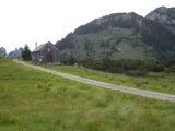
paved road on the Amden side, gravel road on the north side | |||
Hinter Höhi, view to the east | ||||
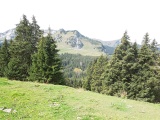
Hinter Höhi, view to the south, with Leistchamm in the background (the westernmost summit of the Churfirsten) | ||||
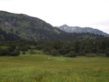
Hinterhöhe as seen from Hüttlisboden | ||||