


Stärnabärg Kulm
 |
LI (LI), 9.5624°E, 47.1193°N | |||
 |
1433 m |  |
LI-1433 | |
 |
Steg | |||
 |
Triesenberg | |||
 |


")
| |||
 |
short summit tunnel | |||
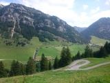
Steg as seen from Sücka, with the road up to the Kulm tunnel | ||||
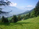
The Rhine valley as seen from Wiega near the old tunnel to Steg | ||||