


Lueglesattel
 |
CH (BE), 7.2923°E, 46.5459°N | |||
 |
1838 m |  |
CH-BE-1839 | |
 |
Rychetsei, 1187m, 6km | |||
 |
Abländschen, 1278m, 5km | |||
 |
||||
 |


")
| |||
 |
almost entirely cyclable pass, except for a few sections close to the top | |||
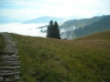
Luegle, view to the south-east towards Rinderberg | ||||
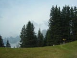
Luegle, view towards Dent de Ruth | ||||

View from Bire towards Luegle | ||||