


Zeinisjoch
 |
AT (VA-TI), 10.1411°E, 46.977°N | |||
 |
1842 m |  |
AT-7-1842 | |
 |
Galtür, 1584m, 6km | |||
 |
Partenen, 1051m, 11km Kops, 1823m, 3km | |||
 |
||||
 |


")
| |||
 |
macadam on the east side (Paznaun) | |||
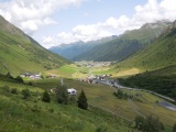
Wirl and Galtür as seen from the road to Zeinisjoch | ||||
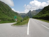
Zeinisjoch and the Gorfenspitze peak | ||||
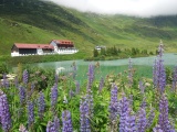
Zeinis lake and restaurant | ||||