


Klausenpass
 |
CH (GL-UR), 8.8551°E, 46.8681°N | |||
 |
1948 m |  |
CH-UR-1948b | |
 |
Linthal, 662m, 22km Unter Friteren, 1310m, 12km Urner Boden, 1372m, 8km | |||
 |
Altdorf, 458m, 24km Unterschächen, 995m, 12km | |||
 |
||||
 |


")
")

")
| Tour 1994 | ||
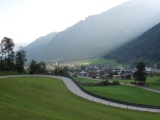
Linthal and the first curves of the road to the Klausen pass | ||||
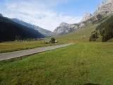
Argseeli and the Urner Boden valley | ||||

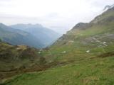
The road of the Klausen pass under the Glatten mountain | ||||

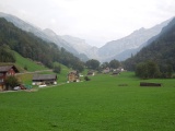
The Urner Boden valley as seen from Vorfrutt | ||||
The Schächental valley as seen from the Klausen hotel | ||||
Unterschächen towards the Klausen pass | ||||