


Col de Vorlaz
 |
FR (74), 6.8053°E, 46.1787°N | |||
 |
2205 m |  |
FR-74-2205 | |
 |
Les Lindarets, 1476m, 6km | |||
 |
Avoriaz, 1829m, 5km | |||
 |
||||
 |


")
| |||
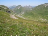
The basin of Cuboré as seen from the Vorlaz pass | ||||
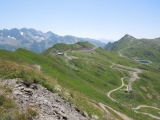
From the Vorlaz pass towards Pas de Chavanette and the Fornets mountain | ||||
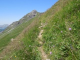
Path on a steep slope between the Vorlaz and Chavanette passes | ||||
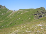
Vorlaz pass as seen from Pas de Chavanette | ||||