


Bocchetta Valle Lunga
 |
IT (SO), 10.2336°E, 46.525°N | |||
 |
2336 m |  |
IT-SO-2335 | |
 |
Passo di Val Trela, 2295m, 1km | |||
 |
Valle Pettini, 1963m, 3km | |||
 |
||||
 |


")
| |||
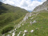
From Bocchetta Valle Lunga towards Passo di Val Trela | ||||
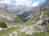
View on lake San Giacomo di Fraéle from Bocchetta Valle Lunga | ||||
Bocchetta Valle Lunga und Val Trela | ||||

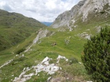
From Bocchetta Valle Lunga, Bocche di Tela can be seen on the left and Bocchetta Trelina can be guessed on the right | ||||
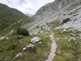
Path between Bocchetta Valle Lunga and Passo di Val Trela | ||||