


Strelapass
 |
CH (GR), 9.7962°E, 46.8129°N | |||
 |
2350 m |  |
CH-GR-2350b | |
 |
Davos, 1552m, 7km Schatzalp, 1861m, 3km | |||
 |
Langwies, 1373m, 8km Chüpfen, 1763m, 4km | |||
 |
||||
 |


")
| |||
 |
(not yet translated into English:) chemin raide mais cyclable sur versant Davos, poussages nécessaires sur les derniers kilomètres du versant Langwies | |||
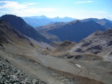
View from the Weissfluhjoch towards the Strelapass, in the background Piz Ela, Corn da Tinizong and Piz Mitgel | ||||
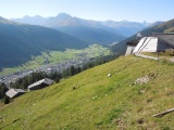
Strelaalp above Davos | ||||
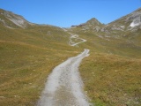
Strelapass, climbing from the south-east (from Davos) | ||||
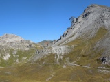
From Strela towards Weissfluh and Weissfluhjoch, with the Schiahorn on the right-hand side | ||||
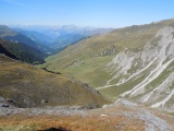
Sapün and the Schanfigg valley as seen from Strelapass | ||||