


Fuorcla de la Valletta
 |
CH (GR), 9.6055°E, 46.4318°N | |||
 |
2586 m |  |
CH-GR-2586a | |
 |
Juf, 2117m, 4km Bleis, 2183m, 2km | |||
 |
Bivio, 1769m, 8km Valletta da Beiva, 2045m, 4km | |||
 |
||||
 |


")
| |||
 |
difficult trail requiring long pushing between the hamlet of Valletta and the elevation of 2300 m | |||
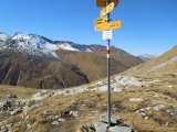
Fuorcla de la Valletta | ||||
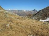
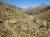
Fuorcla de la Valletta, view to the north-east (towards Bivio) | ||||
View from Fuorcla de la Valletta to the north-east, with from left to right Piz d'Err, Piz Calderas, Cima da Flix, Piz d'Agnel and Piz Surgonda | ||||
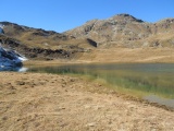
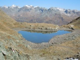
Leg Columban | ||||
In the Valletta da Baiva, with Piz d'Err, Piz Calderas, Cima da Flix, Piz d'Agnel and Piz Neir | ||||