


Farcletta digl Lai Pintg
 |
CH (GR), 9.337°E, 46.597°N | |||
 |
2586 m |  |
CH-GR-2590 | |
 |
Donat, 1035m, 19km Tguma da Tumpriv, 2343m, 6km Lai Pintg, 2312m, 1km | |||
 |
Sufers, 1427m, 11km Versais, 2301m, 3km | |||
 |
||||
 |


")
| |||
 |
rideable up to the Cufertal hut and Alp Nurdagn, respectively, craggy above Lai Pintg, with rubble and boulders | |||
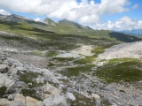
Lai Pintg et (un peu dans les nuages) le Piz Beverin | ||||
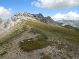
From the Farcletta digl Lai Pintg towards Schwarzhorn | ||||

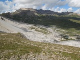
Cufercalhorn and Pizzas d'Anarosa as seen from Farcletta digl Lai Pintg | ||||
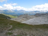
The Piz Calandari as seen from Farcletta digl Lai Pintg | ||||
Cufercalalp | ||||