
 Tour 2010, stage 1: Erstfeld - Oberwald (20 August 2010)
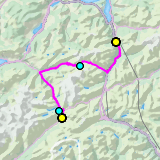 |
105 km |
| 3350 m ^ | |
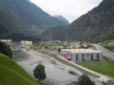 |
Construction site of the Gotthard base tunnel in Amsteg 20-08-2010 09:11 8.6703°E, 46.7817°N, 520m |
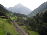 |
Intschi, with the small Windgällen in the background 20-08-2010 09:27 8.6461°E, 46.7575°N, 630m |
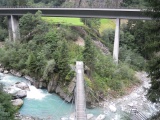 |
Bridge over the Reuss river near Gurtnellen 20-08-2010 09:35 8.6400°E, 46.7403°N, 690m |
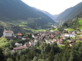 |
Wassen, view towards Göschenen 20-08-2010 10:07 8.6003°E, 46.7100°N, 970m |
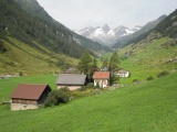 |
Meien 20-08-2010 10:39 8.5453°E, 46.7297°N, 1360m |
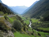 |
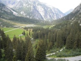
The Meiental valley near Färnigen 20-08-2010 10:50 8.5275°E, 46.7353°N, 1470m |
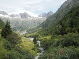 |
Chlialp, (left-hand) lateral valley of the Meiental 20-08-2010 11:02 8.5083°E, 46.7436°N, 1610m |
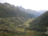 |
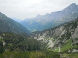
The Meiental as seen from Guferalp, on the Uri slope of the Susten 20-08-2010 11:31 8.4633°E, 46.7431°N, 1950m |
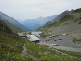 |
At the Susten Pass 20-08-2010 12:23 8.4486°E, 46.7289°N, 2260m |
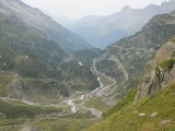 |
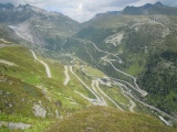
The Bernese slope of the Susten 20-08-2010 12:26 8.4397°E, 46.7306°N, 2190m |
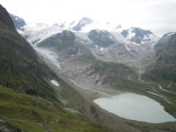 |
Steingletscher and Steinsee 20-08-2010 12:26 8.4414°E, 46.7297°N, 2180m |
 |
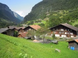
Gadmertal and Gadmen 20-08-2010 12:32 8.4128°E, 46.7331°N, 1950m |
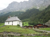 |
Chapel of Gadmen 20-08-2010 12:54 8.3539°E, 46.7381°N, 1200m |
 |
Boden in the Haslital valley 20-08-2010 13:39 8.2683°E, 46.6683°N, 880m |
 |
Handegg, between Guttannen and the Grimsel 20-08-2010 14:53 8.3164°E, 46.6047°N, 1500m |
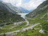 |
The lake of Räterichsboden as seen from the Grimsel dam 20-08-2010 15:43 8.3392°E, 46.5736°N, 1910m |
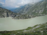 |
Grimsel lake and hospice 20-08-2010 16:04 8.3325°E, 46.5653°N, 2070m |
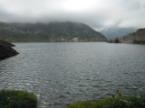 |
Grimsel Pass and Totesee 20-08-2010 16:18 8.3444°E, 46.5619°N, 2160m |
 |
View from Grimsel over Gletsch and towards Furka 20-08-2010 16:22 8.3475°E, 46.5617°N, 2150m |
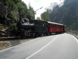 |
Steam train on the old Furkapass line 20-08-2010 16:35 8.3581°E, 46.5603°N, 1750m |