
 Tour 2010, stage 3: Saxon - Martigny (22 August 2010)
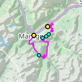 |
65 km |
| 1990 m ^ | |
 |
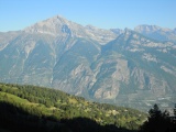
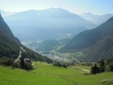
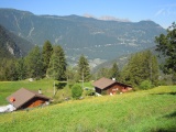
Martigny and th road to the Forclaz as seen from near Sapinhaut 22-08-2010 08:06 7.1650°E, 46.1336°N, 870m |
 |
The Grand Chavalard as seen from above Luy 22-08-2010 09:05 7.1786°E, 46.1200°N, 1500m |
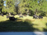 |
Hérens cows at the Lein pass 22-08-2010 09:22 7.1594°E, 46.1122°N, 1680m |
 |
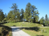
Lein pass 22-08-2010 09:28 7.1578°E, 46.1097°N, 1658m |
 |
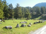
Col du Tronc 22-08-2010 09:34 7.1431°E, 46.1017°N, 1606m |
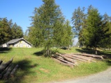 |
Col des Planches 22-08-2010 09:48 7.1244°E, 46.0969°N, 1411m |
 |
Col des Planches, view over Sembrancher 22-08-2010 09:52 7.1228°E, 46.0936°N, 1380m |
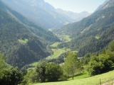 |
The Ferret valley as seen from below Champex 22-08-2010 11:14 7.1267°E, 46.0250°N, 1290m |
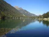 |
The lake of Champex 22-08-2010 11:34 7.1203°E, 46.0275°N, 1470m |
 |
View from Crêtet towards the Dranse valley 22-08-2010 11:50 7.0783°E, 46.0631°N, 1080m |