
 MTB tour Piora - Passo del Sole - Passo delle Colombe - Airolo (10 September 2011)
 |
View over Ambri-Piotta from the upper station of the Piora funicular 10-09-2011 10:37 8.6722°E, 46.5272°N, 1790m |
 |
Piora Funicular 10-09-2011 10:39 8.6722°E, 46.5272°N, 1790m |
 |
Lake Ritóm 10-09-2011 11:03 8.7006°E, 46.5461°N, 1920m |
 |
The valley of Piora as seen from the Cadagno hut towards Pizzo Colombe, with Passo delle Colombe on its left and Passo del Sole on its right 10-09-2011 11:14 8.7208°E, 46.5467°N, 1980m |
 |
Val Piora, view towards Passo dell'Uomo 10-09-2011 12:02 8.7522°E, 46.5414°N, 2180m |
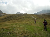 |
Climb along the crest of Alpe Carorescio towards Pizzo Colombe 10-09-2011 12:02 8.7522°E, 46.5414°N, 2180m |
 |
Marcel arriving at Motti, at the crossing of the ways to the passes Sole, Colombe and Uomo 10-09-2011 12:10 8.7592°E, 46.5403°N, 2250m |
 |
Peter (Pischli) at Motti 10-09-2011 12:10 8.7592°E, 46.5403°N, 2250m |
 |
Lorenz arriving at Motti 10-09-2011 12:11 8.7592°E, 46.5403°N, 2250m |
 |
Andri at Motti 10-09-2011 12:11 8.7592°E, 46.5403°N, 2250m |
 |
Fani at Motti 10-09-2011 12:11 8.7592°E, 46.5403°N, 2250m |
 |
Val Piora as seen from Motti 10-09-2011 12:11 8.7592°E, 46.5403°N, 2250m |
 |
Lorenz, Martina, Marcel, Fluppi, Hannes, Fani and Denise 10-09-2011 12:12 8.7592°E, 46.5403°N, 2250m |
 |
Passo del Sole, west side (Piora) 10-09-2011 12:33 8.7708°E, 46.5319°N, 2376m |
 |
Passol del Sole, east side (Acquacalda) 10-09-2011 12:34 8.7708°E, 46.5319°N, 2376m |
 |
Rocks of Pizzo Colombe as seen from Passo del Sole 10-09-2011 12:34 8.7708°E, 46.5319°N, 2376m |
 |
Piano dei Canali, east of Passo delle Colombe 10-09-2011 13:24 8.7786°E, 46.5394°N, 2320m |
 |
Pizzo Colombe and Passo delle Colombe 10-09-2011 13:24 8.7786°E, 46.5394°N, 2320m |
 |
Passo delle Colombe, view from the pass to the east 10-09-2011 13:32 8.7756°E, 46.5392°N, 2381m |
 |
Passo delle Colombe and Lago dei Campanitt 10-09-2011 13:34 8.7756°E, 46.5392°N, 2381m |
 |
Val Piora as seen from Motti, west of Passo delle Colombe 10-09-2011 13:41 8.7619°E, 46.5411°N, 2300m |
 |
Ri dei Calcestri 10-09-2011 13:51 8.7439°E, 46.5397°N, 2130m |
 |
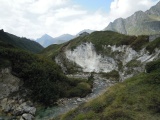
Val Piora and Pizzo dell'Uomo 10-09-2011 13:56 8.7322°E, 46.5431°N, 2020m |
 |
Cadagno hut 10-09-2011 14:00 8.7217°E, 46.5464°N, 1980m |
 |
Cadagno and its lake 10-09-2011 14:05 8.7128°E, 46.5467°N, 1950m |
 |
San Carlo chapel near Cadagno, with the Föisc and Camoghé summits in the background 10-09-2011 14:11 8.7017°E, 46.5467°N, 1920m |
 |
Cadagno di Fuori 10-09-2011 14:12 8.7017°E, 46.5467°N, 1920m |
 |
Lago Ritóm 10-09-2011 14:14 8.7006°E, 46.5461°N, 1920m |
 |
Lago Ritóm, view towards Alpe Tom and (in the clouds) Poncione Gariói 10-09-2011 14:24 8.6792°E, 46.5350°N, 1850m |
 |
The valley of Foss descending from Piora 10-09-2011 14:24 8.6792°E, 46.5350°N, 1850m |
 |
No further comment... 10-09-2011 14:25 8.6792°E, 46.5350°N, 1850m |
 |
Airolo 10-09-2011 14:45 8.6331°E, 46.5269°N, 1270m |