
 Tour 2021, stage 3: Les Diablerets - Croix - Forclaz - Gueulaz - Martigny (21 August 2021)
 |
110 km |
| 2850 m ^ | |
 |
Les Diablerets as seen from the south, from the road up to Col de la Croix 21-08-2021 08:57 7.1564°E, 46.3397°N, 1230m |
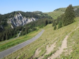 |
Road to Col de la Croix, Les Diablerets's side 21-08-2021 09:36 7.1358°E, 46.3311°N, 1660m |
 |
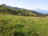
From Col de la Croix towards the Châtillon, Tarent and Pare summits, and further to the right Cape au Moine 21-08-2021 09:46 7.1269°E, 46.3250°N, 1776m |
 |
From Col de la Croix towards the Dents du Midi massif 21-08-2021 09:48 7.1261°E, 46.3236°N, 1770m |
 |
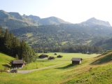
The chalets of La Croix as seen from lower Croix pass 21-08-2021 09:51 7.1281°E, 46.3222°N, 1733m |
 |
La Barboleuze pass 21-08-2021 10:21 7.0703°E, 46.2828°N, 1210m |
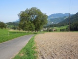 |
From Les Caux towards Châtel 21-08-2021 10:57 7.0281°E, 46.2308°N, 564m |
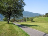 |
From Les Caux towards St-Maurice 21-08-2021 10:58 7.0281°E, 46.2308°N, 564m |
 |
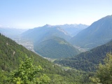
Martigny-Croix as seen from Les Rappes 21-08-2021 12:07 7.0486°E, 46.0847°N, 590m |
 |
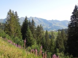
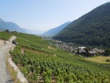
Central Valais and Bagnes valley as seen from the road to the Forclaz pass 21-08-2021 13:21 7.0208°E, 46.0758°N, 1330m |
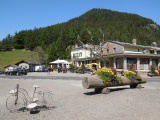 |
At the Forclaz pass 21-08-2021 13:53 7.0011°E, 46.0575°N, 1527m |
 |
Finhaut 21-08-2021 14:15 6.9719°E, 46.0797°N, 1150m |
 |
Sight to the Mont Blanc massif from the road up to the Emosson dam 21-08-2021 14:45 6.9594°E, 46.0756°N, 1510m |
 |
The Trient valley, Arpille mountain, Litro hamlet and Tête Noire mountain ridge 21-08-2021 14:54 6.9547°E, 46.0719°N, 1610m |
 |
La Gueulaz and the small road down to the Emosson dam 21-08-2021 15:37 6.9375°E, 46.0672°N, 1960m |
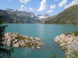 |
Reservoir of Emosson 21-08-2021 15:43 6.9278°E, 46.0650°N, 1930m |
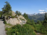 |
Col du Passet near the dam of Emosson 21-08-2021 15:46 6.9275°E, 46.0647°N, 1930m |
 |
Emosson dam and La Gueulaz pass 21-08-2021 15:47 6.9292°E, 46.0656°N, 1930m |
 |
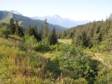
Gravel road between Finhaut and Le Trétien 21-08-2021 16:29 6.9917°E, 46.0931°N, 1190m |
 |
Salvan 21-08-2021 16:51 7.0164°E, 46.1175°N, 950m |
 |
Vernayaz and the Rhone valley from the road to Salvan 21-08-2021 16:57 7.0381°E, 46.1297°N, 750m |