
 Tour 2025, stage 5: Marly - Orsonnens - Châtel-St-Denis (11 August 2025)
| 890 m ^ | |
 |
Es Boux to the north 11-08-2025 10:26 6.9019°E, 46.5514°N, 840m |
 |
Es Boux towards Châtel-St-Denis 11-08-2025 10:27 6.9019°E, 46.5514°N, 840m |
 |
Le Haut d'Ecot 11-08-2025 10:54 6.8789°E, 46.5433°N, 850m |
 |
From Haut d'Ecot to the south 11-08-2025 10:54 6.8789°E, 46.5433°N, 850m |
 |
La Challa 11-08-2025 12:02 6.9242°E, 46.5144°N, 1036m |
 |
From La Challa to Cierne à la Neire 11-08-2025 12:02 6.9242°E, 46.5147°N, 1036m |
 |
Le Pertet 11-08-2025 12:32 6.9153°E, 46.5264°N, 871m |
 |
Le Colet to the south 11-08-2025 12:52 6.9219°E, 46.5372°N, 902m |
 |
Le Colet to the north 11-08-2025 12:52 6.9219°E, 46.5372°N, 902m |
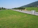 |
Le Crau with the A12 highway northbound 11-08-2025 12:58 6.9136°E, 46.5383°N, 865m |